Friday 18th Jan to Monday 21st Jan '08
I hadn't realized just how badly fouled my fenders were until I went to leave - & had to destroy the homes of several small crabs in cleaning off the barnacles & growth where the ends had dipped into the muddy, tidal, river waters at the Zululand Y.C. where 'Nereida' has been berthed since late November!! That delayed my departure a bit... (Note to self: clean bottom before leaving Cape Town for Atlantic crossing!!)
Having decided to take advantage of a weather window of possibly several days to try to get down towards Cape Town, in the notorious Aghulas Current off the SE coast of Africa, I had quickly to organize 'Nereida' for passagemaking mode - no easy task! On Wednesday, my mainsail had arrived, & Thursday turned out to be a perfect day to deal with that. My newly-repaired ship's compass (actually replaced, thanks to Suunto) needed installing, together with new red LED lights (but the tiny wires needed
extending - a soldering job). The engine freshwater cooling hose was replaced on Thursday afternoon. The repaired autopilot control head was plugged back in place after being brought back from the Raymarine agent, Fonz Marine in Durban. That was an amazingly quick turn-around, thanks to John of 'Stingo', who'd kindly taken it down early Wednesday & come back just in time with it on Thursday night, and Steve Cawdron who worked speedily on the unit as soon as he got it - I'm grateful to both for
their help.
Then there was the actual passage to plan - I'd decided to try to find the maximum current which meant staying well out from the 200m line (often not too far from the 1000m line, the coastal shelf being so steep-to in a lot of places). Having had so many warnings & heard so many horror stories about heading down in the Aghulas Current, I was very keen to get the passage over & done with as fast as possible - & very intrigued to find out what my own experience would be, hoping for good speed - up
to 11 knots, perhaps. The worry was that I'd heard of 'local, unforecast, SW blows' being likely to come up unexpectedly out of nowhere. With the strong SW-going current, very nasty sharp waves would quickly build up & cause major problems.... However, the forecast looked good, so I kept to my plan of going well-offshore.. but I determined to use the engine as & when necessary in calms or for motor-sailing in light winds from astern, to make sure of maximum speed & minimum time 'at risk'!! The
weather window seemed to be good enough to make East London (, at least, in one 'hop' - this being the first possible stop after Durban - & maybe Port Elizabeth or even Mossel Bay. A SW looked likely on the last day of my 5-day forecast, so it was unlikely that I'd be able to round Cape Aghulas against that on this passage - but I'd be keeping a careful eye on the weather, in case that scenario changed.
I finally left around 2.30pm and was then told by Port Control to wait for a big ship to enter the harbour entrance before I could exit. Just outside the harbour is a large shallow area to avoid and several ships further out at anchor. (Richards Bay is the biggest coal terminal in the world, they tell me, with 3 ships a day leaving for China fully laden with lignite. It also has a bauxite facility and two power plants - a rapidly-growing, sprawling, industrial area, but with plenty of wild parks
nearby & open areas. The hospitable Zululand Yacht Club is beautifully situated with excellent facilities, although far from shops.)
The passage started out with minimal wind on the nose, SE 2-3 (~5-10kn), which overnight become NE 2-3, gradually increasing over Saturday to NE 5 (~20kn) by early Sunday. My course took me just W of S to the 1000m line off Durban (~70mls) and then SSW to off East London (~250mls), on SW to off Port Elizabeth (~135mls) and finally W about 200 mls to Mossel Bay over Monday. Soon after sunrise on Sunday, the wind died almost completely and then came up from the SW minimally, dying down to nothing
overnight. Monday saw just SE2-3. The current was SW/SSW flowing and gave a superb 'push' (I would estimate easily up to 5-6 knots at times!) once we got out to the deep water. But it also meant pretty rough conditions, except when the wind died down completely. Even when the wind was in the NE (and so with the current), the long SW swell, typical of the Indian Ocean, together with the NE 'wind waves', again made for lumpy seas. So most of the passage was fairly rough, until Sunday night & over
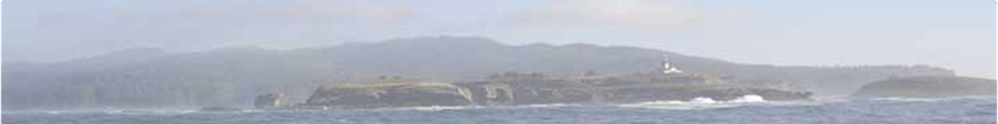
Monday, with a lovely sunny calm last day, passing S of Cape Seal and Knysna harbour and so on to Mossel Bay.
The net outcome of the NE or SW wind and the strong current flowing in our direction of travel was, unfortunately, a lot of motoring with either light apparent wind from astern or wind directly 'on the nose'. I did NOT wish to be caught out in 'SW buster' in the strong current, so I made sure we kept going, mainly motoring at around 5-6 knots (I kept engine revs down for fuel economy) with sails contributing as much as possible plus current..... which gave speeds over the ground of mainly 7.1-11.2
knots (I actually saw over 12 knots quite a few times)!! Friday's speed was just over 7 knots, Saturday's, 8.6-11.2 (!), Sunday's was 10-11 knots up to around 9pm when we left the deep water off St Francis Bay, being then SSW of Port Elizabeth. The noon-to-noon run over Sat/Sun was well over 250 mls!!! I'm sad to say, I only managed a joyous, peaceful sail for a couple of hours - in bright sun on Sunday afternoon, when a SSW wind was off the nose sufficiently and strongly enough for a beautiful
closehauled sail. Earlier on Sunday, 3 pilot whales cruised by and late that afternoon we were surrounded by a large number of curious dolphins...
As I finish writing this, we are 15 miles off Mossel Bay and it is nearing sunset. We shall have covered 670 miles since leaving Richards Bay on Friday afternoon! I hope to drop anchor some time after 9pm - it is said to be good holding in sand - and I shall enjoy a good meal and rest before going on around Cape Aghulas - the furthest point south in Africa and in my circumnavigation, being further south than the Cape of Good Hope which is just over 80 miles to the NW.
I had NO radio communications until Sunday: neither voice nor email/weather.... too close to the stations concerned! The speed log was not giving a reading (must clean impellor before I leave Mossel Bay!), I could only estimate current and wind speed (although at least true wind direction is fairly obvious from reading sea surface!!) AIS was VERY useful - so many ships around..