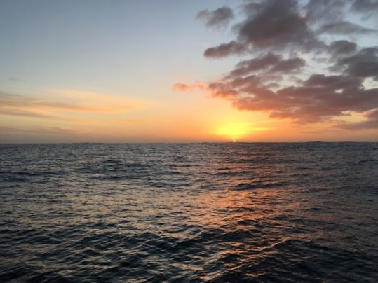
Thursday 10:30am NZT (Wed 2230GMT) A dull, cold, grey day but the wind is up. New Zealand's South Island coast is 100 miles off to NW - still just showing in top left corner of AIS screen. We're well heeled over in good wind (for a change!), on a close reach, heading NNE and trying to make more easting when possible.
Really missing the wind direction display down below. That would help me to be more efficient sailing close to the wind - have to keep looking out to see where the Superwind (wind generator) or mast-top Windex are showing the apparent wind to be coming from.
Looks as though we'll be well off Chatham Islands as a result of the forecast winds which are presently from E, which is exactly the direction I'd been hoping to sail in. We're likely to be roughly on this northerly course all today. If wind backs slightly tonight and into tomorrow, as forecast, we'll end up being forced to head due N and, if getting too close to North Island, we'll later have to head SE for a bit until the wind veers again. Forecast wind direction for tomorrow night onward is good, allowing a course to be laid more to NE, then E, although the wind is likely to turn light overnight tomorrow. Win some, lose some!
Being on starboard tack means I have a practical problem due to heeling to port. That's where the bunk and bedding are still damp from our knockdown but it's also the best place to be. I've had to lay some plastic over the damp port settee so I can sit there in comfort - it's impossible to sit and relax on the opposite (dry) settee when heeled over as much as we are, sailing upwind. Sleeping there is just about OK with the lee cloth in place to prevent me from falling out of the bunk! It's also a lot more difficult moving about doing anything when heeled over like this, pounding into the waves on occasion.
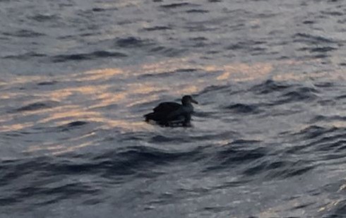
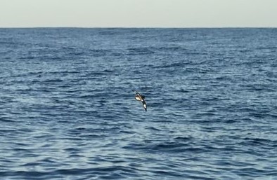
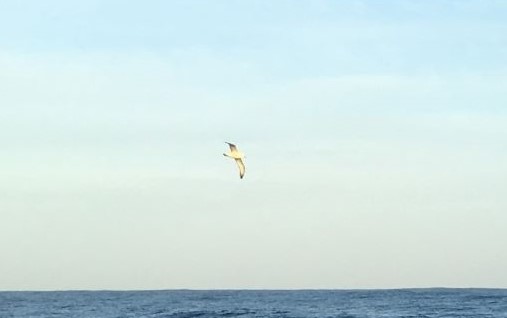
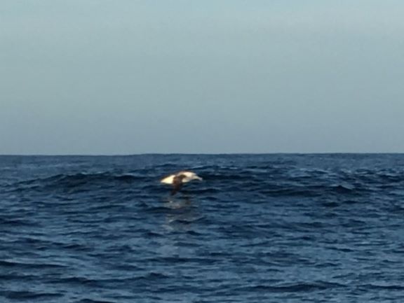
5pm Light fading at the end of a dull day. Just finished watching birds nearby, after taking in 2nd reef in mains'l and furling some genoa - sailing close to the wind of 20kt, we were heeling in rough seas far too much with so much canvas out, so it was time to reduce sail - especially with night coming on very soon. Took a time to organise, but once done, it was time to watch the birds enjoying the strong conditions. Always a thrill to see a Royal albatross in with the others - a Sooty was seen again and, of course, Cape Petrels ... the usual gang!
Now sailing across the Cook Strait but 100 miles off to its SE. The Strait, between North and South Islands of N.Z., is showing clearly in the top left corner of the AIS screen.
I'm waiting to see if the wind backs little, as forecast. Would be good if we can maintain our present course of NNE overnight, without worrying about getting too close to land.
Enjoyed a hot bowl of thick soup - great to have it ready & just needing heating up in the cold cabin.
Friday 12:45am NZT (Thurs 1245GMT) It's well gone midnight and I've just spent over an hour trying to persuade the plotter to stay on and its circuit breaker not to trip - without success... It keeps firing up for a few minutes, and then the breaker trips. Have taken out cockpit instruments one by one - no joy. Have cleaned breaker spade terminal and another connection that was possibly damp ... no joy. After cleaning the breaker terminals, the red LED came on instantly, which it hadn't been, there having been a distinct pause previously before that happened and then the plotter would come on... This seems, to my mind, connected to the fact that everything is very damp just now - the air is damp and there's a lot of condensation everywhere... When the air is dry, this problem goes away... Will have to investigate more in daylight. Getting back for some sleep now.... but will set an alarm to wake me up to keep an eye on things. We've plenty of sea room just now and no ships nearby.
1am Tried switching on again before getting to my bunk - plotter has stayed on now, seems OK....
4am Plotter off again after staying on for a good few hours ... Grrr!!! ... left it... Running generator.
7am Total overcast - first light now, daylight increasing. Wind dying but speed dropped right down after good overnight wind and speed. Still from ENE so course between N and NNE - waiting for wind to veer more S so course change more to NE can be made. Trying to keep well off coast - SE portion of North Island, at E end of Cook Strait, between Castle Pt and Flat Pt, is 50 n.ml. off.
Very little sleep overnight - disturbed by trying to deal with plotter problem. AIS is showing position relative to coast - good to see when plotter not on. Plotter is presently only staying on for just long enough to see position on chart.... All very frustrating .. especially with weather not playing ball as well...
Posting some bird photos from Monday and Tuesday that I got ready earlier.
****************************************************
While sailing around the world, I'm trying to raise funds to help support the superb life-saving work done by the RNLI (Lifeboats) in Britain each and every day of the year, regardless how bad the weather. In fact, the worse it is, the more likely they are out there, helping someone in distress - whether a swimmer, surfer, small boat or big ship, night or day, summer or winter. They are all volunteers with normal day-jobs who respond immediately to a call and it is a charity - no government funding - so they rely on our help to fund their intensive training and maintain their equipment.
It would be great if you would take a moment to click on the Lifeboats link here (https://www.justgiving.cdue tom/fundraising/Jeanne-Socrates2), if you'd like to show your support for my efforts at sailing solo, nonstop, unassisted around the globe, trying to set a World Record as the oldest person to do so, by donating something towards the great work the RNLI do every day. If a lot of people put in even a small amount, it all adds up... Thanks a lot! If you can help, it will be very much appreciated. Let's see if we can reach my target!
***************************************************
1900GMT (= 7 a.m. NZT) - end of Day 253. We made a fair distance between the two 1900GMT positions but unable to measure, due to instruments misbehaving just now.
Total distance covered from Victoria, B.C., to end of Day 253 (by daily DMGs): 20,347 n.ml + some for last 24hr.
Distance to nearest coast of N. Island (between Castle Pt & Flat Pt): 50n.ml. (at 1900GMT)
Position, as posted to www.Winlink.org and www.Shiptrak.org (using my US callsign KC2IOV):
TIME: 2019/06/13 19:00GMT LATITUDE: 42-10.96S LONGITUDE: 176-13.27E
COURSE: 015T SPEED: 3.0kt
WIND_SPEED: 10kt WIND_DIR: ENE SWELL_DIR: NE SWELL_HT: 3.5m CLOUDS: 100%
BARO: 1009.3hPa TREND: -2 AIR_TEMP: 15.0C SEA_TEMP: 14.0C
COMMENT: Almost past Cook Strait. Wind down, speed down, plotter down